
Fichier:Map of Souli.jpg
Fichier d’origine (3 677 × 3 367 pixels, taille du fichier : 1,99 Mio, type MIME : image/jpeg)
Ce fichier et sa description proviennent de Wikimedia Commons.
Description
| Description |
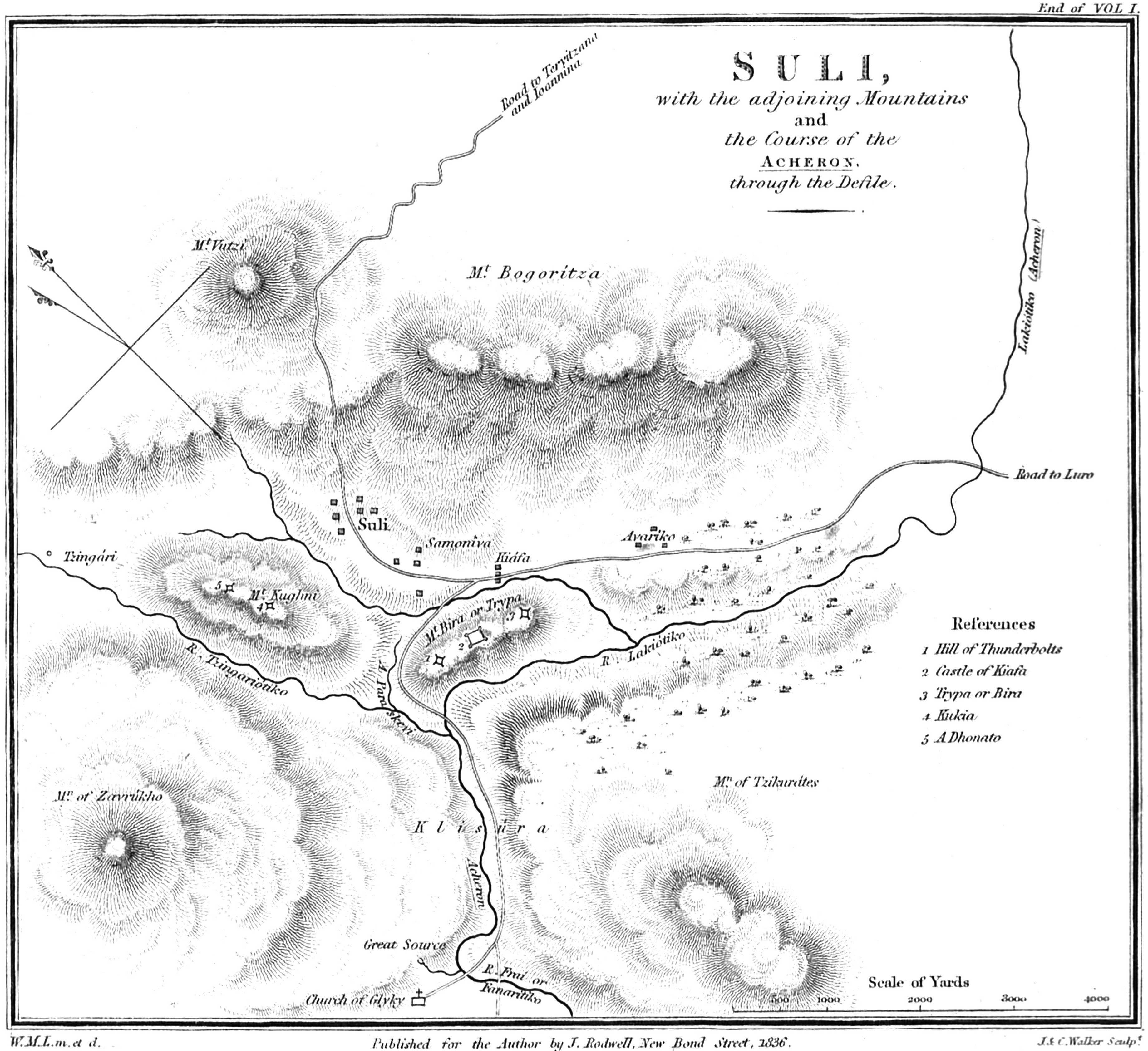
English: Map of Souli and the adjoining mountains and the course of the Acheron |
||||
| Date | |||||
| Source | William M. Leake, Travels in Northern Greece Vol. 1 | ||||
| Auteur | WM Leake | ||||
| Autorisation (Réutilisation de ce fichier) |
|
||||
Conditions d’utilisation
|
Cette œuvre est également dans le domaine public dans tous les pays pour lesquels le droit d’auteur a une durée de vie de 70 ans ou moins après la mort de l’auteur.
| |
| Ce fichier a été identifié comme étant exempt de restrictions connues liées au droit d’auteur, y compris tous les droits connexes et voisins. | |
Historique du fichier
Cliquer sur une date et heure pour voir le fichier tel qu'il était à ce moment-là.
| Date et heure | Vignette | Dimensions | Utilisateur | Commentaire | |
|---|---|---|---|---|---|
| actuel | 24 juillet 2010 à 14:59 | | 3 677 × 3 367 (1,99 Mio) | Phso2 | {{Information |Description={{en|1=Map of Souli and the adjoining mountains and the course of the Acheron}} |Source=William M. Leake, Travels in Northern Greece Vol. 1 |Author=WM Leake |Date=1835 |Permission={{PD-old}} |other_versions= }} |
Utilisation du fichier
La page suivante utilise ce fichier :
Usage global du fichier
Les autres wikis suivants utilisent ce fichier :
- Utilisation sur de.wikipedia.org
- Utilisation sur el.wikipedia.org
- Utilisation sur en.wikipedia.org
- Utilisation sur mk.wikipedia.org
- Utilisation sur sq.wikipedia.org
- Utilisation sur sr.wikipedia.org