
Fichier:Colonisation 2007.png

Fichier d’origine (1 425 × 625 pixels, taille du fichier : 44 kio, type MIME : image/png)
Ce fichier et sa description proviennent de Wikimedia Commons.
| Description |
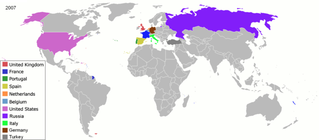
Map of major world powers by year, derived from public domain animated map on wikipedia.
As the orriginal licence of the animation was Public Domain, this image which has been derived from it is too:
|
||||||||||||||||||
| Date | |||||||||||||||||||
| Source | public domain animated map by ArdadN here | ||||||||||||||||||
| Auteur | ArdadN | ||||||||||||||||||
.jpg)
._LOC_2001620596.jpg)

|
Cette image (de type historical map) devrait être recréée dans un format vectoriel, en tant que fichier SVG. Cela offrirait plusieurs avantages : voir Commons:Media for cleanup pour plus d'informations. Si une version SVG de cette image est déjà disponible, merci de bien vouloir l'envoyer. Après cela, remplacez ce modèle par {{vector version available|nouveau nom d'image.svg}}.
|
Historique du fichier
Cliquer sur une date et heure pour voir le fichier tel qu'il était à ce moment-là.
| Date et heure | Vignette | Dimensions | Utilisateur | Commentaire | |
|---|---|---|---|---|---|
| actuel | 1 mars 2019 à 00:06 | | 1 425 × 625 (44 kio) | Nioktest | Coloration en bleu de Mayotte et de La Réunion, départements de l'état français. |
| 22 mai 2010 à 03:51 |  | 1 425 × 625 (75 kio) | Kieran4 | Add Aruba and Curacao | |
| 3 mai 2008 à 19:31 |  | 1 425 × 625 (56 kio) | SelfQ~commonswiki | {{Information |Description= |Source= |Date= |Author= |Permission= |other_versions= }} | |
| 22 mars 2007 à 12:41 |  | 1 425 × 625 (65 kio) | Roke~commonswiki | {{Information |Description=Map of major world powers by year, derived from public domain animated map on wikipedia. {{Maps of world history}} As the orriginal licence of the animation was Public Domain, this image which has been derived from it is too: { |
Utilisation du fichier
La page suivante utilise ce fichier :
Usage global du fichier
Les autres wikis suivants utilisent ce fichier :
- Utilisation sur en.wikipedia.org
- Utilisation sur oc.wikipedia.org
- Utilisation sur vi.wikipedia.org